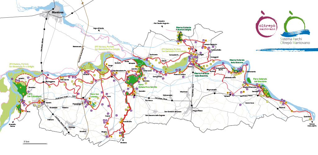
The cycle route system
![]() Rest Area
Rest Area
![]() Infopoint
Infopoint
![]() Mechanics
Mechanics
![]() Rest Area – Infopoint
Rest Area – Infopoint
![]() Bike point – Rest Area – Infopoint
Bike point – Rest Area – Infopoint
Park System bikes are available at the Bike Points
Cycle Routes in the Mantuan Oltrepò Parks System (SIPOM)
Cycle routes inside the SIPOM
![]() Paved routes
Paved routes
![]() Dirt routes
Dirt routes
![]() Gravel routes
Gravel routes
![]() Routes outside the SIPOM
Routes outside the SIPOM
![]() Viewpoints
Viewpoints
![]() Railways
Railways
![]() Railway stations
Railway stations
![]() Motorway A22
Motorway A22
![]() Motorway A22 junctions
Motorway A22 junctions
![]() Roads
Roads
![]() Waterways
Waterways
![]() Urban centres
Urban centres
![]() Nature Reserve
Nature Reserve
 LPSI (Local Park of Supra-municipal Interest)
![]() SPA (Special Protection Area)
SPA (Special Protection Area)